TRAIL MAP

Moderate Difficulty

Distance
(from the trailhead on the Circuito Chico road)
5.8 km
(total up to Pico Turista)

Elevation gain

Duration
3 hs. plus the return trip to Pico Turista

How to get there
![]()
![]()
HOW TO GET THERE
From downtown Bariloche:
Bus: Line 10. Get off at the entrance towards Colonia Suiza (gravel road). Walk 200 mts. towards Bahia Lopez to a Kiosk next to the López creek and trailhead.
Bus: Line 20. Get off on Av. Bustillo km 18.3, then take bus line 13, which goes in to Colonia Suiza and then exits to the Circuito Chico road. Get off when the bus joins the paved road again and walk 200 mts. towards López creek.
SUBE card needed to pay bus fare. Check timetable.
By car: Take the Av. Bustillo until the roundabout of km 18. Continue to the left by the “Circuito Chico”, passing through the Panoramic lookout until the López creek. Free parking at the beginning of the trail.
![]()
SERVICES
- Between July and December there may be lots of snow. Recommended for those with lots of experience. Snowshoes, crampons and ice axe may be necessary.
- From January to March the trail is way more accessible (no snow, so no special gear required).
- The trail is well marked.
- Take extra shoes as you may have to wade through a creek close to the hut.
![]()
![]()
DESCRIPTION
The trailhead is very easy to find. There is a kiosk right next to the López creek and lots of cars parked close by. Right at the beginning the trail is kind of confusing so lookout for the red markings. After a few minutes of hiking next to the creek the trail veers off left and gets a little steeper. Keep a good step as there are loose rocks and roots. The trail is pretty eroded due to all the hikers so have suitable shoes and a hiking pole is very handy.
After roughly an hour you will get to a hut called “Roca Negra”. The trail continues just across from the hut, look for the red markings, it will come out to the 4×4 vehicle road a couple of times, continue on the switch back trail. Then it joins the road until it gets to the López creek, which depending on the time of the year may require you to wade through.
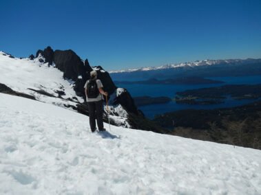
From the López Hut you can continue up to a small tarn “La Hoya” and a little further up to “Pico Turista” (2.060 m.a.s.l.) Be very careful on this section as there are lots of loose rocks and a fair amount of scrambling.
Round trip up to Pico Turista is roughly 3 hs. Check with the hut keeper for the trail conditions and only head up if you are experienced in this terrain. There are loose rocks and there may be snow even in summer which can cover the red markings. The first section up to “La Hoya “ is the most technical and is advisable to hire a Mountain Guide.
The way down is by the same trail, be careful with the junctions and identify features on the way up to recognize going down.
To improve the trekking experience, it is recommended to contact a Mountain Guide authorized by the AAGM (Argentine Association of Mountain Guides)


