TRAIL MAP

Low Difficulty

Distance
1.5 km. (one way from Puerto Pañuelo to trailhead)
2.5 km. (from parking area at Villa Tacul to the lookout point)

Elevation gain

Duration
2 hs. (return trip from Villa Tacul)

How to get there
![]()
![]()
HOW TO GET THERE
From downtown Bariloche:
Bus: Line 20. Get off at Puerto Pañuelo (Llao Llao) at km 25 of Av. Bustillo. From here continue walking along the paved road of Circuito Chico, 300 mts. passed the Llao Llao Information Center, on the right hand side is the trailhead.
SUBE card needed to pay bus fare. Check timetable.
By car: Along the “ Circuito Chico” loop road, 1 km. after Puerto Pañuelo (km 25 of Av. Bustillo), on the left is the Information Center and parking lot (free). You can also leave the car at the paid parking at Puerto Pañuelo and walk from there. From here another 300 mts. along the paved road, on the right hand side is the trailhead going to Cerro Llao Llao and Villa Tacul.
![]()
![]()
- Respect the instructions of the municipal authorities (Park ranger).
- Entry hours in summer: between 8 hs. and 22 hs.
- Check the status of the trails and the weather. On windy days the park remains closed.
- Walk only on marked trails.
- Overnight stay is not permitted.
- Before entering, you must REGISTER at the Llao Llao Municipal Park and PAY AN ADMISSION. It can be done here. There is also a QR at the entrance to the Municipal Park. It is paid through the website (credit or debit card, or in cash through Rapipago or Pago Fácil). For Bariloche residents, retirees and children under 12 years of age the admission is free.
- Careful while walking along the paved road, many cars and bicycles.
- Watch out at the lookout as there are many cliffs, especial attention with kids.
- Do not leave valuables inside the car.
- There are areas with no cell service.
- Camping and fires are not allowed.
- Take back all your trash and dispose properly.
![]()
![]()
![]()
DESCRIPTION
The main trailhead to reach the Llao Llao peak is 1,3 km. from the bus stop at Puerto Pañuelo continuing along the paved road. This is 300 mts. after the Information Center and parking lot (free).
The trail is well marked with the sign “Villa Tacul – Cerro Llao Llao”. After 2 km. there is a turn off well marked left to head up towards the peak. The trail starts to gain altitude and nice views of the Nahuel Huapi lake.
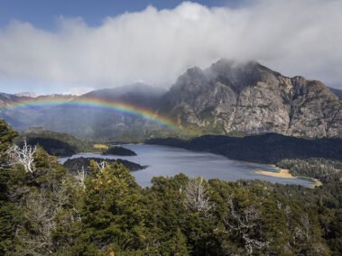
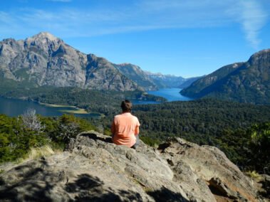
Once past the structure of a big telecommunications antenna, the lookout is on the right with views of the Llao Llao peninsula and “Circuito Chico” loop. Lakes Moreno, López and Capilla peaks and the Tristeza branch of Nahuel Huapi lake. Watch out for the cliffs, especially with kids.
Descend along the same trail, taking a right at the junction to head straight back to Llao Llao or take a left and continue on to Villa Tacul. It is roughly 1.500 mts. to the parking lot and another 500 mts. to the lakeshore.
Another way of accessing the peak if you have a car is continuing along the paved road after Puerto Pañuelo to the sign and detour right to “Villa Tacul”. Follow the signs to the end of the road and parking area. From here backtrack 100 mts. along the road and then a left turnoff and well-marked signs showing the trail up to the peak.
This trail is a little shorter, only 1.5 km. At the junction take a right and begin the ascent to the peak, same way back down and time to enjoy some of the nearby beaches.
Stay on the trail at all time, bicycles are not allowed.
Camping and fires are not allowed.
Take all your trash back with you.
To improve the trekking experience, it is recommended to contact a Mountain Guide authorized by the AAGM (Argentine Association of Mountain Guides)


